London Wall
Few of the teeming crowds that run for the bus or taxi, from office to home, could ever realise that London was once a walled city and that only a couple of centuries ago these massive walls and gateways disappeared. How many of them stop to think what Ludgate and Houndsditch really meant?
Yet it is still possible to trace out the whole length of the old Roman wall and at various points still touch the very stones, bricks and tiles that our Roman ancestors touched two-thousand years before.
The Roman's found three hills on the north bank of the Thames, Ludgate Hill, Cornhill and Tower Hill. This constituted the Roman London.
Fortifications were erected by the Romans on all four sides of the oblong space. Sufficient remains of the Roman structure have been unearthed to also show the Norman and Medieval walls not only followed the old wall but were built on top of the older foundations. According to ancient records, the wall was three miles long, 18 feet tall, and had fifteen lofty towers. The riverfront side was two and a half miles long.
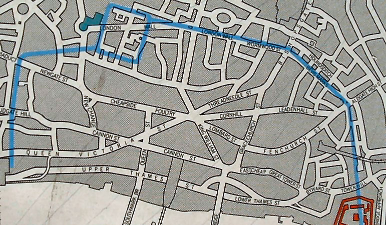
Map of the Roman London Wall
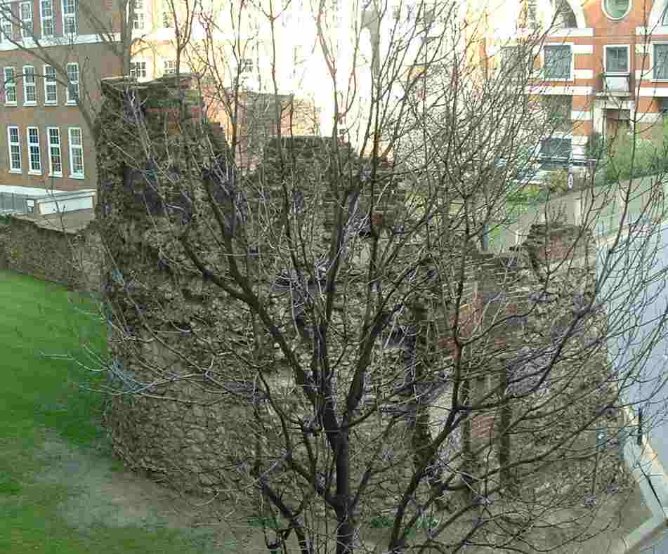
The map with a blue line indecating the line of the Roman Wall (above) shall be the route we take around what is left of the ancient Roman wall. At the bottom of our map, starting at Trinity Place on Tower Hill, where we can see our first section of Roman wall, a large section, which is ten ft wide and over twenty ft high. In the little area beside the wall we see the statue of the Roman Emperor Trajan.
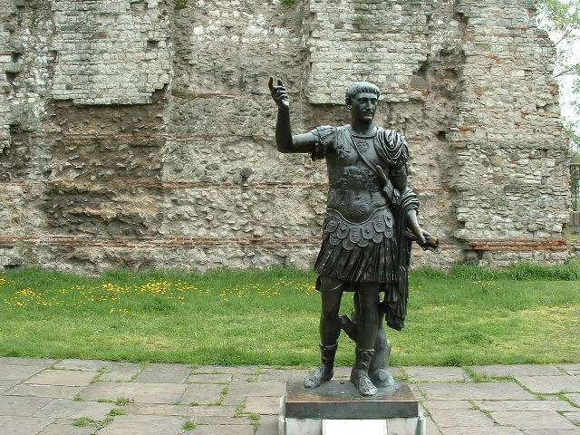
Roman Emperor Trajan
The statue of Trajan is an outdoor twentieth-century bronze sculpture depicting the Roman Emperor Trajan, located in front of a section of the London Wall built by Romans, at Tower Hill in London.
The statue was installed in 1980 as a bequest from P. B. "Tubby" Clayton, the vicar of All Hallows-by-the-Tower. The Museum of London believes the figure to have been recovered from a scrapyard in Southampton in the 1920s. There is no information presented at the site about the sculptor.
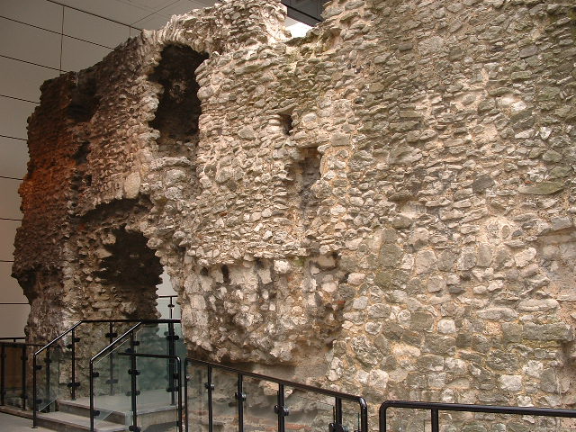
Coopers Row section
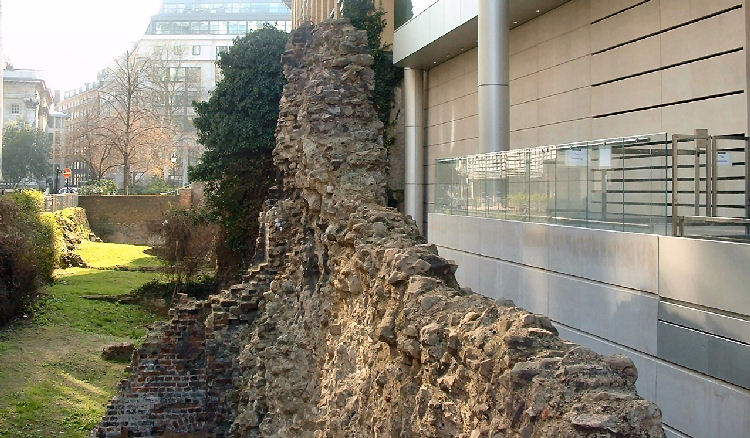
Follow along Coopers Row, where a section can be seen in a courtyard of a new office building. It goes near the rear of the Fenchurch Street station and then along America Square, then inside another modern building. It passed up Vine Street, into Crutched Fiars and Jewry Street, where it is visible (by private arrangement) in the basement of the Institute on the right in Roman Wall House.
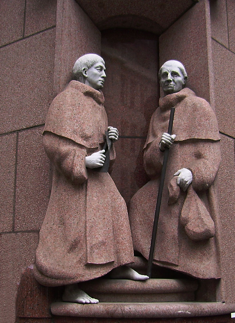
A statue of two Crutched Friars inset in a modern office block
The Wall would then crossed Aldgate, one of the Roman gates, which leads from London, through Whitechapel, Mile End and leading along the A12 to Colchester. We cross Aldgate into Duke Street Place and onto Bevis Marks, although nothing of this section remains, although in Camomile Street a bastion was uncovered eight feet below the surface. On the side of a building is a marking of the site of Bishopsgate.
During the time of Henry III, there was an order for the Hanseatic League of Merchants to keep the gates in good repair. The Bishop had to keep the hinges in order. Bishops Gate then crosses into Wormwood Street and then onto the modern London Wall roadway.
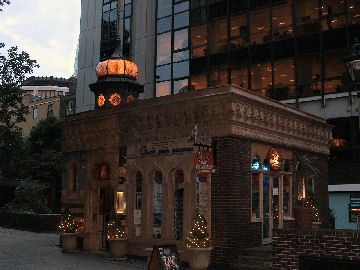
Whilst we are at Bishopsgate, it will be worth a slight detour through the churchyard to see the old Turkish bath. When they were developing this area during the 1970s, the baths were then the "Gallioli" a trendy Turkish restaurant complete with belly dancers. fortunately, the developers could not manage to entice the owners to sell, they were holding out for more than the developers were prepared to pay, so the building escaped the bulldozers.
Walking back down Bishopsgate and right into Wormwood Street then continuing along the street named London Wall, the next place of interest is St Alphege.
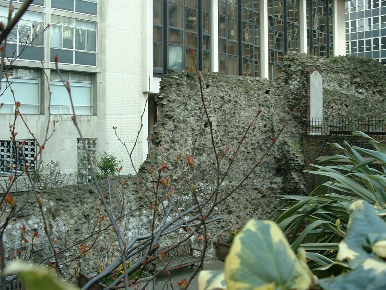
St Alphege Norman Remains
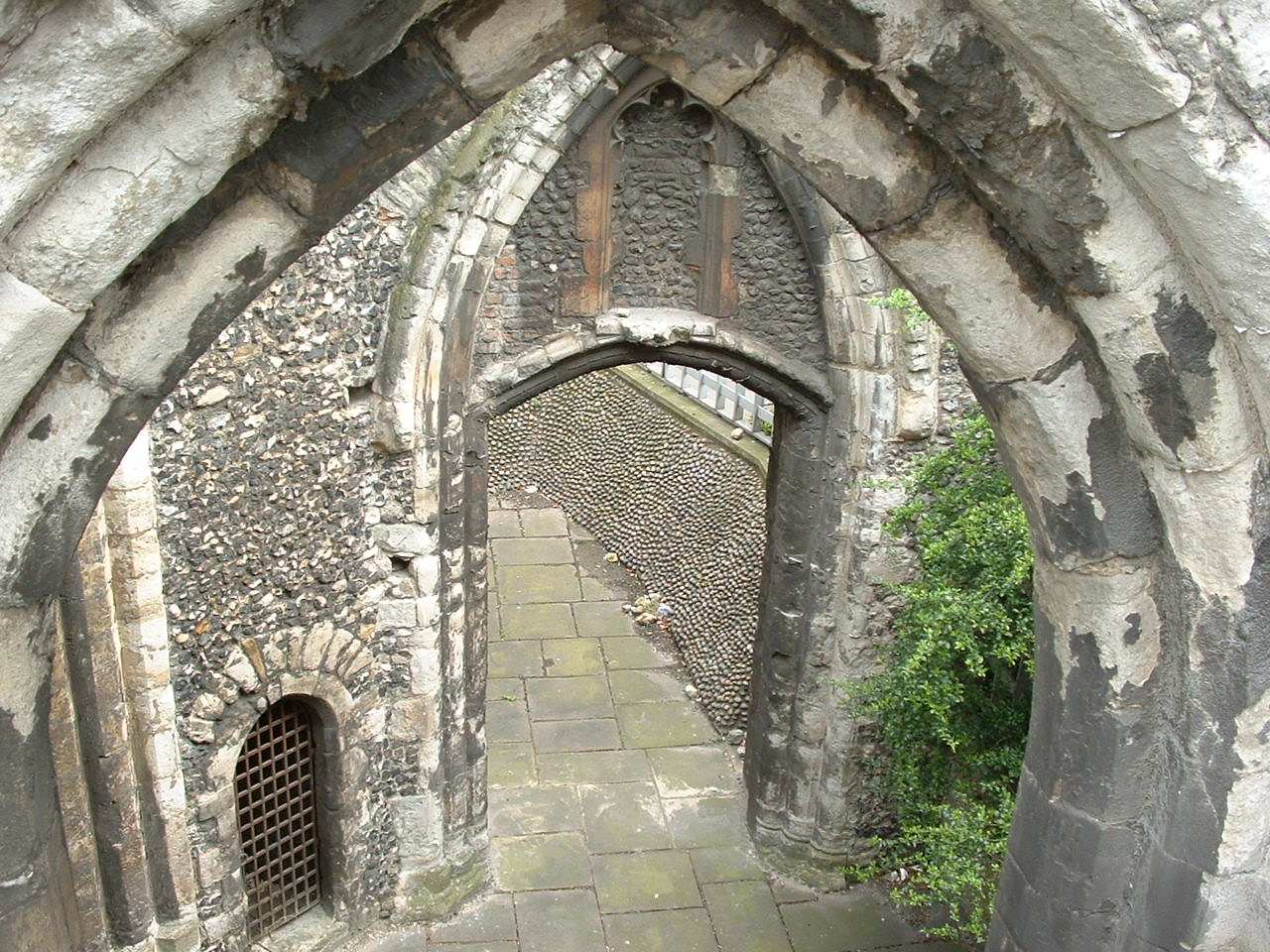
The surviving remnants of these consist of the ruin of a central tower, built of flint and rubble masonry.
Remainig arches on three sides; the south wall is missing.
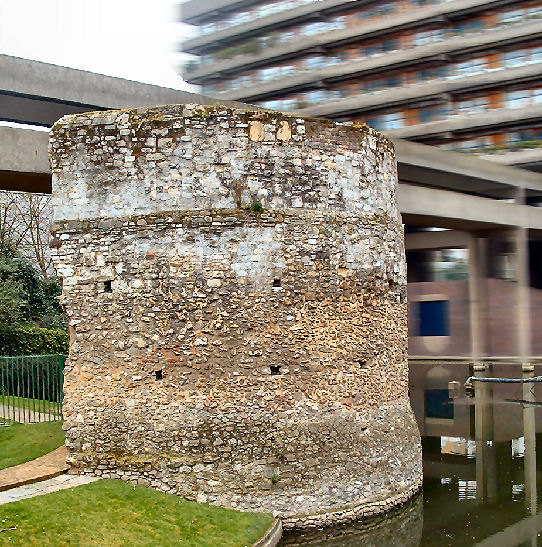
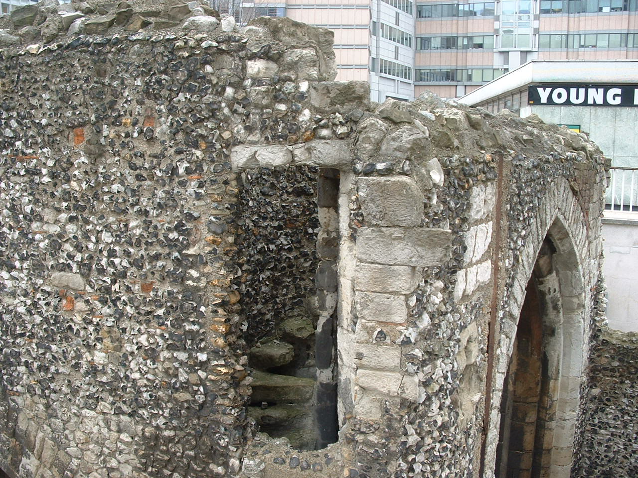
Round Tower at Cripplegate.
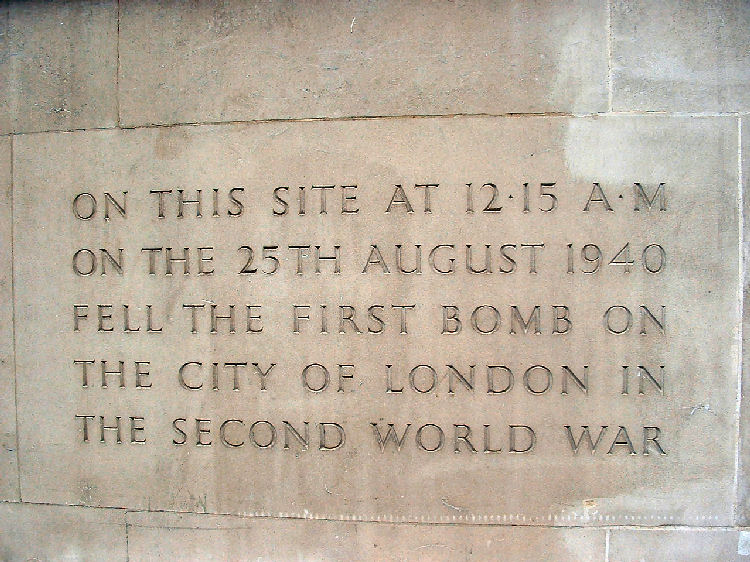
Roman Wall House, World War II inscription. Some of the bombing around this part destroyed some sections of wall, but also revelling sections long forgotten.
At the side of the Roman Wall in Wood Street - by the modern building Roman Wall House - the site where the first city of London Bomb fell in 1940.
A bastion round tower can be seen in the car park of Bastion House, next to the Museum of London.
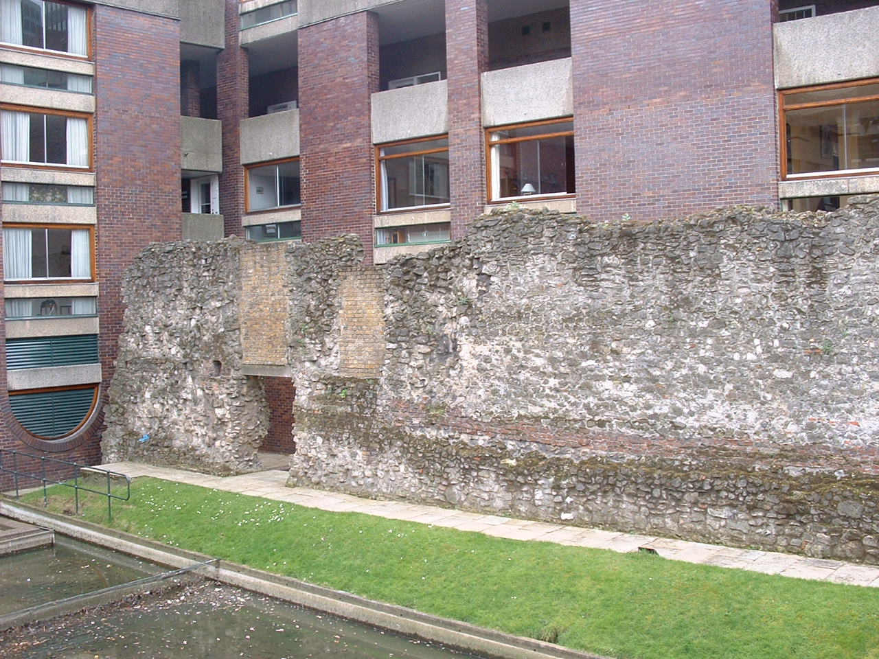
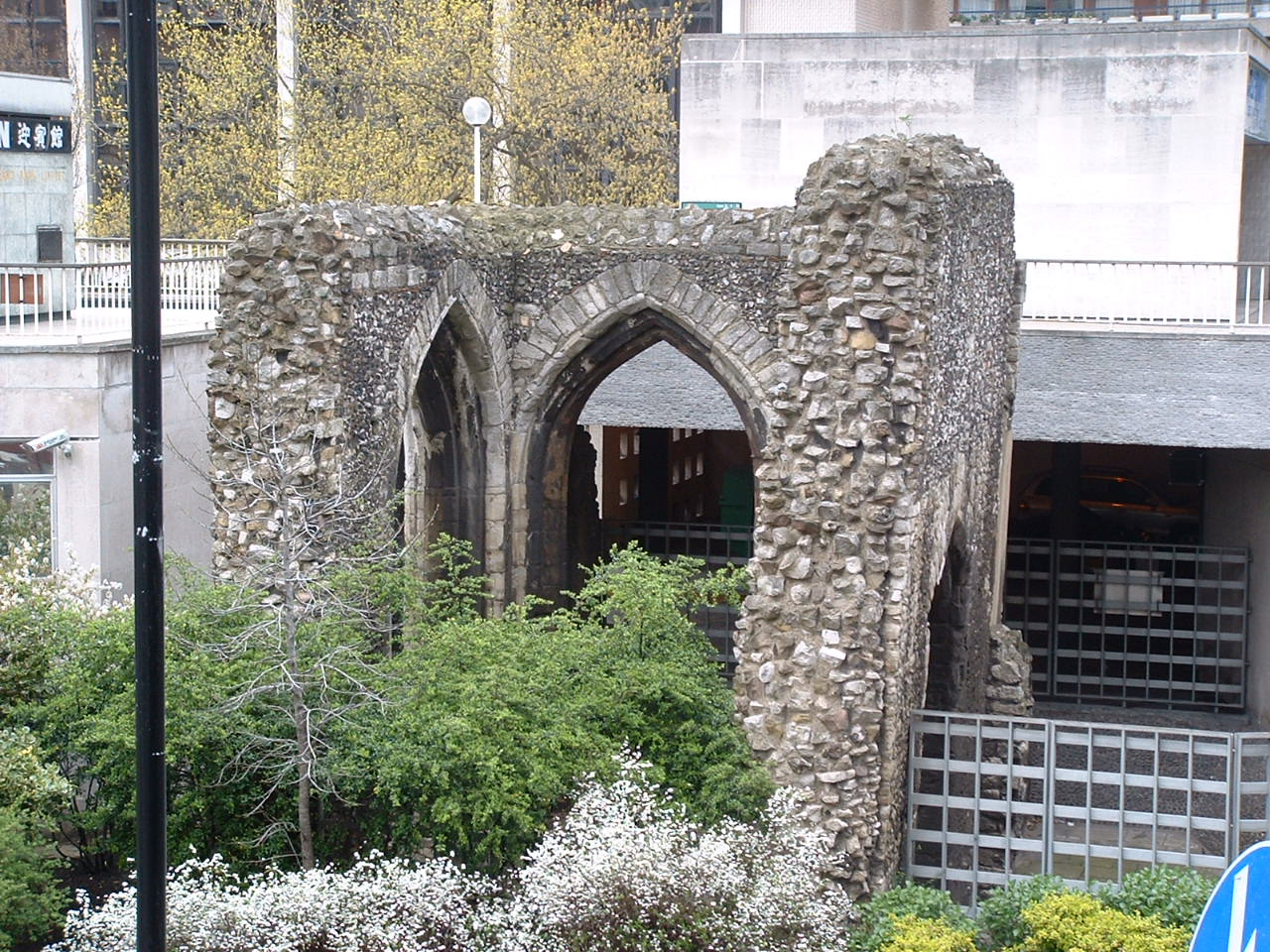
Noble Street section.
Crossing the roadway into Noble Street, large sections of wall are still standing. A fifteen-century map shows a bastion, forming the north-west corner of the wall, the position of which you may see by going down to Newgate Street, turning right and then another right at Guiltspur Street, where a few yards up the Myrill Lynch yard way is on the right. The Post Office HQ stood here before Myrill's took over the site. During the Post office building works two bastions were destroyed. Bits of the wall can be seen by request, although with high-security alerts nowadays this might not always be possible. It then ran across Newgate Street - another Roman gateway - and alongside the central criminal courts, better known as the Old Bailey. Roman London, remember, is ten or twelve feet below our present street level. The wall then went down Pilgrim Street, through the new Thameslink station at Ludgate, and into the Thameslink at Blackfriars. It came to a sudden stop at the Thames, where the Mermaid theatre now stands. The embankment was widened, as the Mermaid theatre was built on the edge of the Thames. As the builders worked under Blackfriars bridge on the new underpass, a sunken Roman vessel was discovered.
Map of the Roman London Wall
London Time

Follow Us
The contents of this website are the property of knowledgeoflondon.com and therefore must not be reproduced without permission. Every effort is made to ensure the details contained on this website are correct, however, we cannot accept responsibility for errors and omissions.
© Copyright 2004 -
Contact Us | Advertise